Public Channels
- # ai4pacificislandseabirds
- # animal_re-id
- # audio
- # biodcase-active-learning-community
- # camera-traps-hardware
- # camera_traps
- # camtrapai-workshops
- # cv4animals
- # cv4plants
- # cvml-solutions-for-challenging-real-world-conservation-problems
- # datasets
- # elephant_id_database_general
- # esa_2023_happy_hour
- # general
- # geometric_embedding_analysis
- # help_needed
- # jobs
- # marine
- # movement
- # new_papers
- # news
- # ourpapers
- # petitions
- # proj-id-and-count-salmon
- # public-engagement
- # random
- # region-pnw
- # region-us-ne
- # region-us-sw
- # resources
- # tdwg_ml
- # upcoming_events
- # vibe-coding-party
- # visualization
- # what-is-that
- # wildlifeinsights

@Suzanne Stathatos has joined the channel
set the channel description: Marine data management, workflows, common tools, and common pitfalls discussions


@Luke McEachron has joined the channel


@Jason Holmberg (Wild Me) has joined the channel


@Oliver Broadrick has joined the channel
Hi all! To evidence my interest in our aquatic friends, here are some pictures https://oliverbroadrick.com/html/troutpics.html

Hi everyone! We had our first FathomNet workshop a few months ago (workshop videos playlist here), and we’ve been collating input from the workshop in this document here. If you’re interested (and have the time), it would be great to have you all take a look and add any suggestions, etc. We’re hoping to take this doc and derive functional requirements to get FathomNet from beta to v1.0 in late July. Really appreciate it!


@Mitch Fennell has joined the channel


@Joanna Turner has joined the channel

@Alexander Robillard has joined the channel

I added this to the lila.science "list of other conservation data sets":
https://lila.science/otherdatasets
...and this also tipped me over critical mass to break things out by topic a bit, so there's a section for "aquatic image data sets" now, for example:
https://lila.science/otherdatasets#images-marine
Let me know what I'm missing!

Hi guys ! Wondering if you know of any marine mammals video dataset ?
Hi Maxime, I think this might be what youre looking for? I realize they are photos but they might give you a lead to some video.
https://www.fisheries.noaa.gov/inport/item/17940
might be able to chase something down from this as well- https://www.fisheries.noaa.gov/new-england-mid-atlantic/science-data/artificial-intelligence-right-whale-photo-identification


NOAA is hiring for an Interdisciplinary Computer Scientist/Physical Scientist/Fish Biologist at the Southeast Fisheries Science Center
https://www.usajobs.gov/job/668184500
https://www.usajobs.gov/job/668184600
New dataset of images (with ~70k bounding boxes on fish and crustaceans) extracted from nearshore video cameras, courtesy of NOAA Fisheries:
https://lila.science/datasets/noaa-puget-sound-nearshore-fish
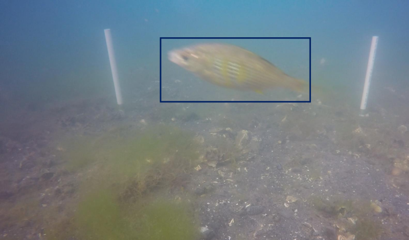
Hey all, we have a pre-print for our new manuscript based on some of my dissertation work. Long story short we tried to build an computer vision application to enable indigenous peoples in the Peruvian Amazon to inventory/document the types of fish they have. The data, which comes from a combination of museum and field specimens, will eventually be made public on figshare (after review). We'd love any and all feedback, please dont hesitate to message me!
https://www.authorea.com/users/503098/articles/582899-application-of-a-deep-learning-image-classifier-for-identification-of-amazonian-fishes

Came across this repository of papers/datasets and thought it’d be useful to share here 🙂
https://em4.fish/our-library/
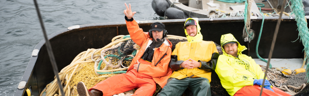

1st Workshop on Maritime Computer Vision (MaCVi2023) at WACV2023 in Hawaii, which will host four maritime challenges:
- UAV-based Object Detection
- UAV-based Multi-Object Tracking
- USV-based Obstacle Segmentation
- USV-based Obstacle Detection
Winners will be featured in a challenge overview paper published in the WACV Workshop proceedings (included in IEEE Xplore).
We also solicit submission of original research papers.
Important dates for MaCVi2023:
Challenge results submission
25-Oct-2022
Paper Submission deadline
25-Oct-2022
Paper acceptance notification
14-Nov-2022
Paper camera ready deadline
19-Nov-2022
MaCVi20203 workshop
3-Jan-2023
For more information, please see the MaCVi2023 homepage
Excited to share with the community our first official FathomNet publication in Scientific Reports. Check it out, share it with your networks. Looking forward to receiving your feedback! https://t.co/G1gLUdNDde May also cross post this in the general channel as well.

Congrats @Kakani Katija and team!!
Incredible work! Retweeting this asap 🐥
https://twitter.com/kakanikatija/status/1574831108591472640?s=46&t=67AR-OwKTXqpAkPya5veUw

 Twitter

Hello, ! My name is Zhongqi Miao. I am a research scientist from Microsoft AI for Good Research Lab, formerly a PhD from UC Berkeley, and a post-doc from UW. I am currently working on fish group segmentation from echosounder imagery and would like to know whether anyone here is also working on or knows someone working on similar echosounder datasets. We have pretty successful results on segmenting hake schools from large-scale echosounder imagery collected by trawling ships, and I am considering expanding this project to other use cases of echosounders in marine science and oceanography.
Hi @Zhongqi Miao! Super cool. What kind of echosounder are you using and what is the setup for capturing these images (attached to the bottom of a vessel at sea?) ? I'm trying to figure out what exactly is shown in these photos you attached
Yes, @Justin Kay , these are echosounders (ek60s I remember) attached to the bottoms of trawling ships traveling along the west coast.
I'd reach out to Kelly Benoit Bird at MBARI
@Kakani Katija Thank you very much for sharing!
@Taiki Sakai - NOAA Affiliate know anyone at NOAA working with this kind of data?
Yeah, I know the hake data I previously worked on at UW was collected and provided by NOAA fishery. But I wasn’t sure who exactly collected the data when I was there.

the active acoustics group that would have this kind of data is pretty separate from the passive acoustics group I work with, but I can ask around!
Thank you so much for your help @Taiki Sakai - NOAA Affiliate !

Hi @Zhongqi Miao I work at Scripps Institution of Oceanography and we have been collecting this kind of data for a few years now to try to understand the foraging behavior of marine mammals with the backscattering layer pattern. So I would be happy to chat more with you and learn on what you have done and what you expect from your analysis.
Thank you so much for replying @Alba Solsona! I would also be really happy to chat!
Here are some inference prediction results we have on some smaller segments with ground truth to compare:
It is great to connect with you and please let me know what you think! Thank you so much!
P.S. The echosounders we were using are attached to the bottom of trawling ships sailing along the west coast. The data I am currently working on are collected from EK60 echosounders. Here is an example of a full echosounder image:
So are the axes of this image y=depth and x=time? With color indicating backscatter?
Yes @Justin Kay, y is depth and x is time. The three channels are actually backscatters of three different frequencies 18kHz, 38kHz, and 120kHz (representing B, G, R respectively). In the previous two examples, I also have separate representations for each of the frequencies on the left.
RGB channels represent backscatters of 120kHz, 38kHz, and 18kHz frequencies. y is depth and x is time. The maximum depth is about 1.5km.

Hey all! My name is Shir Bar, I'm a PhD candidate at Tel Aviv University and the Interuniversity Institute for Marine Sciences in Eilat. For a side-project I'm involved in, I was wondering if anyone could point me in the direction of an image dataset of Indo-Pacific fish species? (a Red Sea one would be even better , but I won't be too greedy🙂 ) I'm specifically looking for images taken under natural conditions, i.e., in the field (or reef).
Thanks!

Cross-posting because of relevance 🙂

Hi everyone! Don’t forget to sign up for the FathomNet workshop using the link here. More details in this flyer. Please share with your networks!

Hello, for those of you who are interested, we have just published BrackishMOT: a MOT dataset with nearly 100 video sequences of marine animals captured in the wild (mainly focusing on small fish in brackish/turbid waters, but there are other animals too).
https://www.kaggle.com/datasets/maltepedersen/brackishmot
Very cool, I added it to a running list I keep of marine/freshwater image/video datasets:
https://lila.science/otherdatasets#images-marine
We're getting close to a critical mass where we ("we" as in "the whole community") might be able start training a general-purpose detector for fish-shaped things in a variety of ecosystems, but I don't think we're quite there yet, so please let me know if I'm missing datasets!
As per the previous thread on this channel, I think we're getting close as a community to having a sufficiently diverse collection of public datasets where fish have been annotated with bounding boxes (or segmentation labels that could be used as bounding boxes) that one could train a pretty general-purpose fish detector that would facilitate data review and downstream species classifier training. I'm thinking of BRUV-like deployments where the visual concept of "fish" matches the colloquial concept of the word, i.e. not things like fish in drone images seen from above the surface, or microscopic images, or fish on the decks of ships, etc. Basically fish that look like 🐟, 🐠, 🦈, etc. In a perfect world I'd like to do other high-level taxa that would appear in the same videos (e.g. crabs), but it doesn't look like the state of public data is quite there for other taxa yet.
So... to move the ball forward a little, I'm inclined to at least set the table for getting metadata for all of the public datasets that fit the bill into a common format (preferably COCO). After a thread on the general channel here, a few of us just did this for aerial and drone wildlife datasets:
https://github.com/agentmorris/agentmorrispublic/blob/main/drone-datasets.md
...and I'd like to do basically exactly the same thing for "boxes on fish" datasets. IMO if you can download the data, load the annotations, and render random annotations onto sample images, you're 99% of the way to converting to a standard format.
Questions for this channel:
- Is anyone already working on a general fish detector that kind of fits this vibe?
- Is anyone else already working on aggregating all of those datasets into a common format?
- Am I missing any boxes-on-fish (where segmentation masks can be reduced to boxes) at https://lila.science/otherdatasets#images-marine?
- Is anyone else sufficiently fired up to lead this exercise? 🙂

Hi Dan, we have been actively working on this and I have a yolov5 model trained on roughly 250K images I believe of fish using public datasets (we have a list going here: https://github.com/dxyang/awesome-fishies) as well as code to download and parse a variety of datasets into YOLO darknet bboxes. I am happy to share these all next week once I clean it all up a little bit.
So I guess answer to all 4 questions is yes :P
Will also attempt to convert over to COCO since darknet is extremely unwieldly to share.
That's fantastic! I'd definitely like to test-drive that model... I trained a model just on the NOAA Puget Sound dataset, and even that was almost good enough to be useful on a few other test videos that I came across, but not quite good enough. So I think what your describing will be super-duper-useful, if it's trained on the datasets you list there. I'll take no action here other than staying tuned!
And actually I did one more thing: I broke my list of marine image datasets:
https://lila.science/otherdatasets#images-marine
...into two categories, one where fish look fishy, suitable for the kind of thing we're talking about on this thread:
https://lila.science/otherdatasets#images-marine-fish
...and one with a more nuanced concept of "pictures of marine life" (drones, sonar, etc.):
https://lila.science/otherdatasets#images-marine-nonfish
I also added a few to the former.
Wow, once you start looking...
Another amazing data set that squarely fits the bill:
https://zenodo.org/record/7250921#.ZEAmZezMJqs

Very interested to follow this. The closest work I've seen to achieving this is in https://www.frontiersin.org/articles/10.3389/fmars.2022.944582/full which used the Ozfish dataset. They are working with EventMeasure/Seagis which is a really popular software for annotation of underwater video surveys. Its also used for collecting length measures from stereo video data which is key for biomass estimates, which they're also working to automate. There's a website here: https://www.afid.io/


If object detection can be done for fish, there are instantly hundreds of thousands (probably more) annotated datasets to the species level in event measure, only catch is they use points on the fish not boxes. But if a point falls in a bounding box it could be applied to the box ofc.
@Ben Williams Are those points with species-level annotations public? Or, maybe asking a different way, my understanding is that SeaGIS doesn't have a giant public database, but I think you're suggesting that lots of EventMeasure users would be willing to make their data public. Is that accurate? Or is there already a place I don't know about that's publicly available where EventMeasure users are already putting images with annotated points?
Points with species level labels, and yeah not publicly available unfortunately. This would be data SeaGIS users would have to share. I was at the Reef Conservation UK conference last year and actually did some asking around as to who had datasets and would be willing to share. Quickly hit >100k labelled fish from talking to a handful of labs (including our own). I also spoke to the founder of SeaGIS (jseager@seagis.com.au) who stopped by ZSL a few months back who I believe mentioned they have some large datasets and are interested in this space. They are collaborating with the author of the above paper currently.
Hi all, apologies for the delay, had a lot of juggling to do.
We have just released the codebase for parsing your own datasets as well as some pretrained models you can start with. Details are located here: https://github.com/warplab/megafishdetector
That Kakadu dataset looks cool too, will try to incorporate if I have spare time (though feel free to contribute!)
We would also be interested in the point labels if that really is a reasonable thing to get somehow. We're also pretty bottlenecked on compute if anybody with access to machines is interested to collaborate at all.
Excited to try this out! Documentation looks very straightforward.

Oh nice! Will look into it too.
I am (very slowly) working on a project to detect Manta Rays.
Hello again, we have just published an article on re-identification of giant sunfish; yes, that's their name, and yes, they are giant 🐟
The pipeline is very simple and requires no training or finetuning.
https://www.mdpi.com/2077-1312/11/5/889

Just tried Segment Anything on some very randomly chosen screengrabs from transects we're filming and imaging on reefs in Indonesia. Looks like the demo version does an alright job at pulling out many key objects. Anyone tried or seen applications for reef habitats? Not much more to report, just thought it looks neat with plenty of food for thought!
Hi @Ben Williams, SAM seems to work fairly well on images captured in marine environments from my experience too. I developed one of the datasets Meta evaluate on in the Segment Anything paper (NDD20), and out of curiosity (as they only show one example in the paper) ran some more of the dataset’s images through, and was quite impressed! Would just need some way of deciding what segmentations are actually useful for the task at hand. Some random examples:
I also tried SAM on some fish-packed reef frames and it seems to do really well in segmenting even with occlusions. As for the question of deciding what segmentations are important.. I tried a repo that combines segment anything with Grounding DINO, to search for objects in the frame using textual prompts and then segment them. My first impression is that the performance of DINO is a bit patchy, but for objects that take up a decent amount of pixels it works well. It also seems to help SAM create better segmentation masks (like in the pufferfish example).
We ran a succesful hackathon on image data at the Mars HOPE Reef project! Read the article here: https://buildingcoral.com/news/mars-data-scientists-turn-their-skills-to-coral-reef-restoration

What makes a frame "interesting"? I don't mean in the prototype (you indicated that for now "interesting" is motion other than the fishing gear), but ideally, what is "interesting"? The presence of any fish? The presence of certain species? The presence of >N fish? The presence of >M fish above/below a certain size?
Asking because there are a couple AI models that exist already that might be useful for you as starting points, depending on exactly what you're trying to find, though it's still early days for generalizable models in this kind of imagery.
But, FWIW, models that have come up on other threads on this channel that might help you find fish:
https://github.com/ajansenn/KakaduFishAI
https://github.com/warplab/megafishdetector

Thanks for your question! Interesting for us changes based on context.
In pot fishing, >N animals (crabs, lobsters, scallops, etc) opens up the possibility of on-demand harvesting rather than burning carbon by checking frequently.
In dynamic gears (such as trawls), it would be more interesting to know numbers and species of fish, particularly if that can be processed in-camera and transmitted to the vessel skipper and enable them to make decisions. There is a company already doing this (Deep Vision by Scantrol), but it's way more tech than we need right now to help the fishing crews we work with (mid-size vessels).
In biodiversity monitoring (for instance, around windfarm moorings), species recognition and tabulation would be useful. That could be done post-retrieval though.
-----
That's another point to make; With our footage, we're working on a retrieve and process basis. That's because we're helping fishing crews see what happened retrospectively so they can make changes. There are use-cases for realtime processing and sending alerts/string-data but for the timebeing they're less useful for our stakeholders (partly because you need further pieces of equipment to respond to the data/insights that would be supplied).
A major issue for us is that we're able to categorise the problem, and have so far been able to build hardware to collect footage and do other things in fishing gear (that's our core competence). CV represents a new step for us, and is something we'd like to partner with an expert on, or contract someone to help us build the MVP.
Those models are super interesting but with our company in its current state is probably like handing a toddler a pair of scissors and asking them to give you a passable haircut 😅 .
We're in a weird phase where we know that implementing this type of processing and visualisation into the camera app we've built will convince a lot of customers to use our camera, but we won't have the funds to build out a software team until our next, more significant funding round (which is what we're building commercial traction to achieve). But we'd also like to boost our traction with this functionality (I just went cross-eyed)...
Understood. Chicken and egg. Or, I suppose, fish and egg. It sounds like your immediate priority is getting a prototype together, more than getting the exact-absolute-best-perfect AI system in place. This Slack community may be slightly less helpful for that, since chatter here tends to focus on the AI pieces. If you have some engineering budget and you can reduce the problem to a neatly-scoped engineering request (try these models, connect A to B, etc.), I would recommend that you try the #need-help channel on the Work On Climate (WoCl) Slack, which is not technology-specific, but is massive, and this kind of request wouldn't be unusual there. In particular, compared to just putting out requests for contracted engineering from a random engineering firm, you're likely to find sustainability enthusiasts on the WoCl Slack who would work at a discount or on a lightweight, low-hours contract.
FWIW if you were a non-profit or academic group doing exactly the same thing (building a prototype AI system to help reduce bycatch), and you could make it open-source, I think you'd even get volunteers there, but even if the sustainability benefit is the same, it's tricky to recruit volunteers for for-profit and/or closed-source projects.
Hope that helps. Good luck!
It really does, thanks Dan! I was hoping that I might have similar luck in this forum to what you suggested for WoCI given the areas of interest of this community. I'm definitely still keen to speak with people who would be interested in the approach you outlined (lightweight, low-hours contract).
I'll try the WoCI too in an effort to raise my luck coefficient 😁 . Appreciating it's an incredibly competitive field, if you know of an engineer who might be up for this please do send them my way. One of the challenges of being a mission-led profit-with-purpose, as you mentioned, is that we often fall outside of the goodwill received by NGOs/academia, despite sharing the same goals 🤝. We're channelling our R&D funds to get there efficiently though.

Hey @Dan Watson Good to see you here! Our team at OnDeck is building stuff for very similar applications. We're also working with trawlers in Canada who would probably love to try some of your hardware. Shoot me a DM if you'd like to chat.
@Dan Watson Hi Dan, sorry for the late reply, I haven't checked Slack for a while. If it is of any interest, your problem could be relevant for my AI/computer vision students at master's level at Aalborg University (in Denmark). Each semester the students work in small groups on a large project that runs throughout the entire semester and we are always looking for new exciting "real" tasks like the one you are describing. It's free research for your part, you only have to provide the data and your problem, however, it comes with the price that you never know whether the group of students is great or mediocre and we cannot promise that the problem will be solved exactly like you want (teaching and research is the main purpose). However, we often see that our students get employed by companies they have worked with after they graduate, so some of them must do something right, at least.
I have worked with underwater computer vision for the past 7 years and I am currently responsible for two large projects on advancing small fishing vessels (for sustainable coastal fishing). Feel free to reach out to me.
Hi everyone. Apologies for the hiatus. Lots going on at SNTech and we've been figuring out our strategy for a range of things.
I'll reach out to folks 1:1 from the responses on this thread. Thanks so much!
Hello everyone, I will have my PhD defense on Friday September 8. My PhD thesis has the title "Exploring New Waters: Advancing Fish Monitoring with Computer Vision" and it has been focused on development of underwater object detection and tracking datasets. From 3D tracking of zebrafish in an aquarium to marine object detection and tracking in the wild. I will give a 45 min presentation at 1pm CET and it will be targeted at a broad audience and focused on my work with a lot of images and videos and very few equations.
If you are interested feel free to join Zoom (see information below). Please note that all participants will be muted during the presentation, but feel free to write to me here or by email if you have questions or comments.
Meeting ID: 693 0837 6828
Security Passcode: 577857
Invite Link: https://aaudk.zoom.us/j/69308376828
Sounds interesting, I will be sure to join -- and good luck for the viva!

Does anyone have/know of a project that tracked humpback whales (via AI/CV/photos/remote sensing/etc)?
Our Flukebook.org platform does individual ID for humpbacks using AI (miewId algorithm) for fins and flukes. Happywhale also specializes in humpback photo ID.
@Taiki Sakai - NOAA Affiliate would likely know of projects
As would Michaela Alksne or folks in her group
https://sael.ucsd.edu/people.html
i just came across flukebook very cool! Are you in the West Indian Ocean?
@Patrick Beukema Portland, Oregon. We support globally distributed research efforts on the platform.
sorry I should have clarified I meant your second point.
Are accounts for the public or is it a more refined thing @Jason Holmberg (Wild Me)?
We generally focus on researchers as our target user. We collect cit sci data, but community engagement (community.wildme.org) focuses on having biologists use our tools for their local work.
I'm mostly tied into acoustics stuff, and I'm not aware of anyone trying to track individual humpbacks using acoustics (sounds are way too complicated already without trying to do something like individual ID / tracking). I do remember seeing at conferences a few talks about detecting whales in satellite imagery, so that's definitely a thing but not sure about getting to the tracking-level of detail

We ran a challenge a while back to re-identify beluga whales using drone footage/photographs: https://www.drivendata.org/competitions/96/beluga-whales/
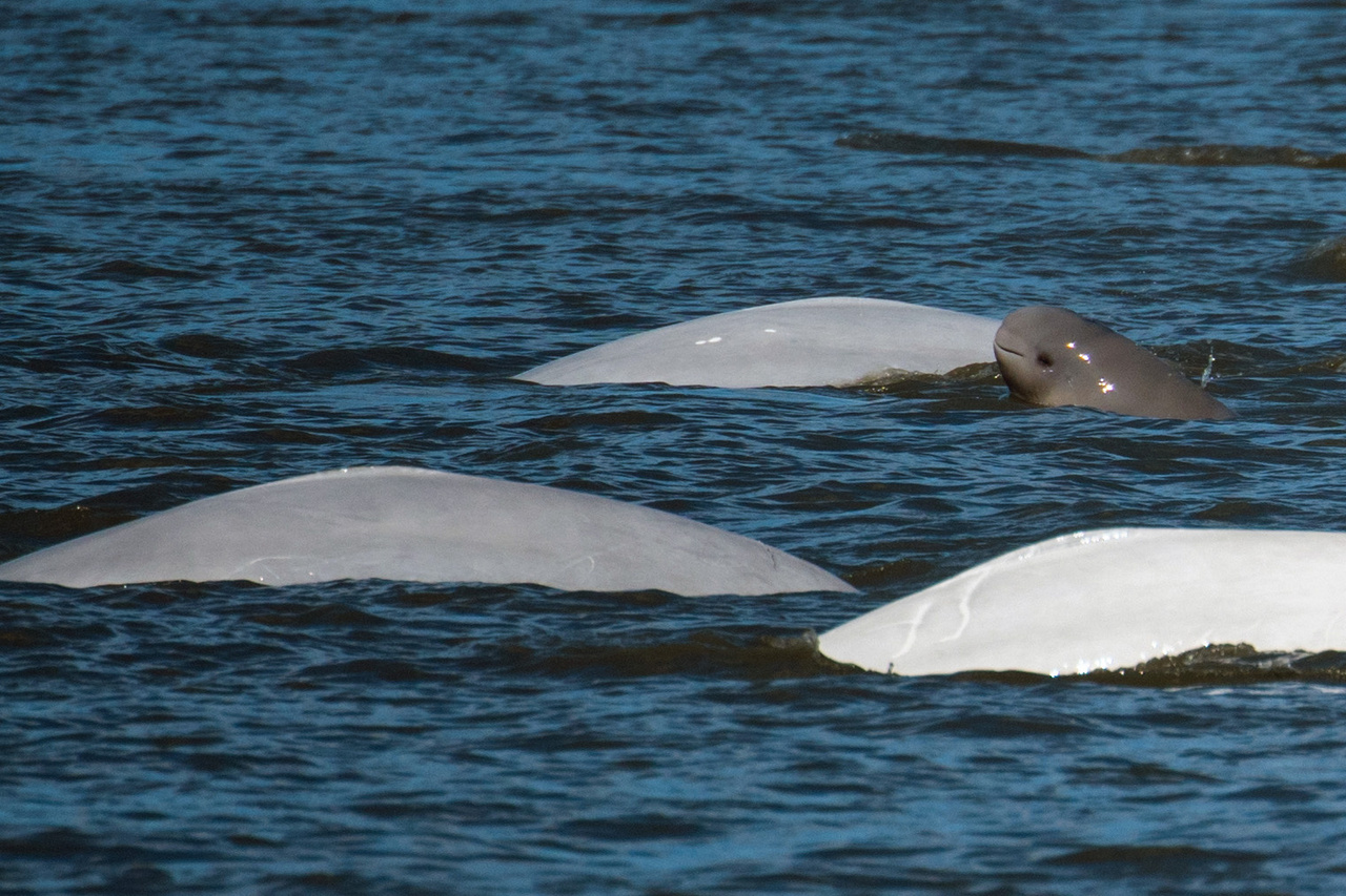
@Christine Chung We've now extended that beluga model and retrained it for multispecies re-ID with 23 species of whales, dolphins, and white sharks.
Sent this workshop via a colleague today, may be of interest to some in this channel:
We are pleased to invite you to submit an abstract to the session ITS1.2/OS4.10 Machine Learning for Ocean Science at EGU2024 (14-19 April 2023).
The conference will be held in a hybrid format, so participation is open both online and in person. Everybody is welcome to submit an abstract:
https://meetingorganizer.copernicus.org/EGU24/abstractsubmission/50283


Webpage of the session:
https://meetingorganizer.copernicus.org/EGU24/session/50283
The deadline for abstract submission is 10 January 2024, 13:00 CET.

The deadline for applying for financial support is 1 December 2024, 13.00 CET, more information here: https://egu24.eu/guidelines/supports_and_waivers.html
Summary:

Machine learning (ML) methods have emerged as powerful tools to tackle various challenges in ocean science, encompassing physical oceanography, biogeochemistry, and sea ice research.

This session aims to explore the application of ML methods in ocean science, with a focus on advancing our understanding and addressing key challenges in the field. Our objective is to foster discussions, share recent advancements, and explore future directions in the field of ML methods for ocean science.

A wide range of machine learning techniques can be considered including supervised learning, unsupervised learning, interpretable techniques, and physics-informed and generative models. The applications to be addressed span both observational and modeling approaches.


Observational approaches include for example:

- Identifying patterns and features in oceanic fields

- Filling observational gaps of in-situ or satellite observations

- Inferring unobserved variables or unobserved scales

- Automating quality control of data


Modeling approaches can address (but are not restricted to):

- Designing new parameterization schemes in ocean models

- Emulating partially or completely ocean models

- Parameter tuning and model uncertainty


The session welcomes also submissions at the interface between modelling and observations, such as data assimilation, data-model fusion, or bias correction.
Hi @Filippo Varini, I'm unsure sorry -- was just sent it via email. It may be worth contacting the workshop organisers.

Hi everyone,
I am a final year MEng Computing and AI student at Imperial College London.
I am writing my thesis on shark biodiversity monitoring with Computer Vision models from underwater videos (BRUVS).
Does anyone have experience with CV for (marine) biodiversity monitoring? I would love to connect and exchange ideas!

Caro Filippo, we work on corals and create joint 3D models and semantic segmentation!
Hi Filippo, welcome to the channel. I work on Marine CV at the British Antarctic Survey, detecting taxa in benthic imagery.
Would be interested in your work on BRUV. During my PhD I very briefly helped another student trial the use of MegaDetector for finding sharks in some BRUV they had, but unsure if it went anywhere. We also have a fair amount of BRUV footage at BAS.
Hi @Filippo Varini! 👋
Also hi @Cameron Trotter. It would be great to chat if you have some time.
Hey all, thought folks here might be interested in a new challenge we're running (in partnership with MathWorks, WHOI, and UMass Boston) to detect the extent of giant kelp forests using Landsat imagery:
https://www.drivendata.org/competitions/255/kelp-forest-segmentation/page/791/

@Steve Haddock That's very cool! What's the end use case for this? To be able to automatically identify kelp species from drone footage?

We are not being super discriminating beyond "Kelp", but we are working toward a time-series of over-water drone images. I'm most interested in jellyfish, but others with the National Marine Sanctuary are interested in changes in kelp canopy, others in turtles, whales, debris, birds, pinnipeds. Depending on where we fly, there are a lot of kelp clusters...
Hi folks. We're looking at entering a proposal for the WILDLABS Conservation Tech call (closing Jan 14th) with a focus on deploying our CatchCam to conduct longer-term monitoring of an underwater environment. We're looking for a researcher to partner with.
Benefits for you:
- Supplied with a CatchCam, which can film underwater down to 800m for 30 days. Totally wireless, plus we're developing post-processed AI assistance in footage review.
Benefits for us:
- We get user feedback on how the camera performed for your needs, features suggestions from an expert end-user and case studies generated from our collaborative deployment.
If this is of interest to you, please reach out and we can brainstorm. This is a funded opportunity.
🐟 🌊
Hello! (disclaimer: this is technically not about conservation, but related...) we have created a large dataset with cod-like fish species photographed on a conveyor belt for (relatively) "fine-grained" classification tasks. This is part of a project regarding automated catch monitoring and documentation on fishing vessels to allow fishermen and authorities to keep track of what is caught in real-time to minimize overfishing, bycatch, etc.. Does anyone know of "similar" datasets (e.g., from fishing vessels, lab setups, factories, etc.)? We have spent quite some time looking for such datasets online, but there are surprisingly few - or we are using the wrong queries when searching for them!?
This doesn't exactly answer your question, but here are all the datasets I'm aware of that include pictures of fish that are not in "natural water" (two are in the water, but in artificial environments, and one is segmented fish that may or may not have been in water in the original images):
https://smithsonian.figshare.com/collections/Data_from_Application_of_a_Deep_Learning_Ima[…]lassifier_for_Identification_of_Amazonian_Fishes/5761097 (segmented fish, not in water)
https://www.fishnet.ai/download (fish on vessel decks)
https://metadata.nmdc.no/metadata-api/landingpage/01d102345aef4639f063a13ea20cd3f3 (segmented fish with empty backgrounds)
https://www.kaggle.com/datasets/jorritvenema/affine (fish photographed by anglers)
https://www.sciencebase.gov/catalog/item/627e8af0d34e3bef0c9a2cde (trout on a fish board)
https://motchallenge.net/data/3D-ZeF20 (zebrafish in a lab)
https://github.com/Salmon-Computer-Vision/salmon-computer-vision (salmon in locks)
https://www.drivendata.org/competitions/48/identify-fish-challenge/page/90/ (fish on vessel decks)
https://www.kaggle.com/c/the-nature-conservancy-fisheries-monitoring (fish on vessel decks)
All of those came from here:
https://lila.science/otherdatasets#images-marine-fish
https://lila.science/otherdatasets#competitions-marine
If you find others, let me know!
Hey @Malte Pedersen -- Fishnet and the Driven Data competition (both linked by @Dan Morris) are the only public onboard fisheries electronic monitoring data I'm aware of but both have limited overlap with what you're working on (Fishnet is tuna and swordfish; the Driven Data data is groundfish on jamaica boards). My company Ai.Fish works on a variety of applications in this space and the data is a big challenge due to privacy concerns, evolving (and often confusing) regulations, and the double-edged sword of regulations encouraging more companies to get involved (double-edged in that more companies are interested, but data is so precious and hard to obtain that no one shares). Fishnet was the largest effort in open sourcing EM data and took years of negotiations with fishermen and industry players, led by TNC. If you have any plans to work toward an open dataset it would certainly be well-received! Would be happy to chat more about your project and see if there's any way we could help.
@Dan Morris your overview of datasets is always the first place I look, when I need something like this. It's extremely valuable 👍
@Justin Kay we will publish our dataset as soon as possible on Kaggle (hopefully within the next couple of months). Our dataset contains instance segmentation masks (manually corrected SAM masks) and IDs for approx. 500 fish split across 6 cod-like species (so they are somewhat similarly-looking, but different species). In total we have approx. 18,000 annotations across 1,500 images.
I will share the link with both of you as soon as it is online.
just forwarding here in case you missed in the general channel

Hi all!
I’m working on a shark tracking project, with the goal of detecting and tracking sharks, to slash BRUVS processing time, allowing researchers to only classify one frame, rather than hundreds of hours of video.
I am facing a challenge with Multi Object Tracker (MOT): our shark detector is solid at 83% accuracy, but integrating MOT causes a significant drop in detections due to the non-linear motion of sharks and frequent crowd occlusions (failure cases and detector-det+MOT comparison attached).
I am currently using the BorSORT tracker form yolo.track.
Does anyone have experience or advice on improving MOT performance in similar scenarios or with underwater models? We’re open to identity swaps as long as tracking remains consistent.
Appreciate any insights or suggestions!
As you can see from the attached pictures, another problem is that BotSORT outputs the MOT-predicted bounding box location (right frames), rather than the original detected bbox (left frames) .
Hi Filippo, have you tried a more traditional tracking approach? If the sharks are generally behaving well (i.e., not exhibiting erratic behavior) and you have good detections, then you should be able to get good tracks simply by looking at, e.g., the Euclidean distance between frames and solving it as a global optimization problem, e.g., using the Hungarian algorithm. We have also had success tracking fish with a cost function based on the Mahalanobis distance as fish/sharks are typically elongated in their swimming direction (when seen from a side- or top-view perspective).
A Kalman filter could also increase performance if the sharks are not behaving erratically.
One more thing, you should take a look at the HOTA performance metric: https://link.springer.com/article/10.1007/s11263-020-01375-2
It gives you more information and takes some of the flaws of the CLEAR MOT metrics and IDF1 into account.

Hi Malte, thank you for the recommendations!
I have briefly tried Kalman filters, but not in depth. Have you used a specific library for implementing these traditional trackers?
@Justin Kay might have some suggestions
Seeing some video might also help with diagnosing what's going on. Can I ask what you need tracking for? (You mentioned you don't care about identity splits -- so wondering what it is you want out of a tracker). I agree with @Malte Pedersen that implementing a simple tracker yourself could actually give you better results and be easier to understand. A lot of papers in MOT are overly complicated because they are competing over a couple percentage points on human tracking benchmarks.
BotSort is based on a Kalman filter approach but has a few extra things bolted on that make it hard to debug. In general I think the trackers included in YOLOv8 are hard to debug and you would probably have an easier time implementing a separate tracker yourself. The original version of SORT could be a good starting point, you will have control over the hyperparameters and can see how changing certain parameters affects performance: https://github.com/abewley/sort
Regarding the boxes post-tracking being different from the detected boxes, that is a property of Kalman filtering based approaches. Basically, the Kalman filter is doing two things in each frame: (1) predicting where existing tracks will move to based on their velocity, (2) associating new detections with existing tracks based on how close the new detections are to the predicted locations of existing tracks from step 1. The final output from the tracker is kind of like an average of the two, because a Kalman filter was designed for systems that have both noisy measurements (= detections in this case) and a noisy motion model -- so they assume the "real" position is somewhere between the two.
Another thing to notice there is that if there is no overlap between a detection and the predicted location of an existing track, SORT will not connect them. So that is probably why you are seeing splits in cases of nonlinear motion. If you wrote a simple tracker yourself, you could instead allow association between boxes/tracks as long as they are within some distance of each other, for example
Justin, thank you so much for the advice. I agree that benchmark trackers seem overly complicated for this task! I will try sort/out of the box trackers and evaluate their performance!
Thank you!
@Filippo Varini we made a benchmark dataset with zebrafish. It was a controlled environment (an aquarium), which is significantly different from your task, but the behavior probably resembles each other and both sharks and zebrafish move in three dimensions.
Maybe you can get some inspiration from the 2D tracking module, which follows a traditional and simple tracking approach (and we found that due to the erratic behavior of zebrafish a Kalman filter didn't improve the performance)
https://github.com/mapeAAU/3D-ZeF
Hi all, I will be going to the Economist World Ocean Summit next week. If you are as well, I would love to meet.
If not, looking forward to share what I learn there about opportunities for AI in Ocean Conservation!

Marine enthousiasts, have a look here to our work on 3D semantic segmentation and reconstruction of coral reefs
https://besjournals.onlinelibrary.wiley.com/doi/10.1111/2041-210X.14307
Hi everyone, I know this is not the "jobs" channel, but I hope it's okay, that I share this in here as well. We have an open PhD position available at my lab in Aalborg (Denmark) focused on underwater computer vision solutions.
https://www.vacancies.aau.dk/phd-positions/show-vacancy/vacancyId/1218564


Hi friends, I've got a few terabytes of coral reef images from GoPros with 90% overlap. The goal is to create a 3D reconstruction for marine biologists to inspect. 10 years ago, I did OpenCV C++ SfM and photogrammetry. What's the best SoTA to use these days? NeRF and Gaussian Splatting? Would the output be a point cloud or a mesh? How much compute/GPUs do we need for it? Have someone already solved this problem? Thank you!
UPD: All ideas are here: wildflow.ai/3d-reef

NeRF studio has a model which tagerts marine environments specifically https://docs.nerf.studio/nerfology/methods/seathru_nerf.html

From https://sea-thru-nerf.github.io
If it's for use for marine biologists, our group primarily uses Metashape (if you have some money and decent access to beefy desktops) or COLMAP (https://colmap.github.io/ open source alternative, but finicky, may also require some other tools depending on what you want). Most of these seathru-nerf-style things require COLMAP/Metashape anyway to get the depth maps/camera poses regardless.

I have been learning about this space in the last few weeks for airborne imagery and can vouch that python bindings for colmap are both powerful and incredibly underdocumented. I have some scripts that work well, but definitely requires a reasonable amount of 3d modeling background. Different use case, for finding homographic points among non-standard overlapping airborne images to reduce double counting for object detection. https://github.com/weecology/DoubleCounting/blob/dd75ce3cc1319ee6227dda982aeee0593461e015/scripts/stitching.py#L18
 <a href="https://github.com/weecology/DoubleCounting">weecology/DoubleCounting</a>
We have been working with @Jonathan Sauder on similar problems since a couple of years with a low tech setup like yours (GoPro videos) and developed a learned SfM model to perform the 3D reconstruction. You can have some extra infos here: https://josauder.github.io/deepreefmap/
We compared with Metashape and Colmap in the paper. For our setups (= cover long transects in video mode, so not so much overlap), those solutions weren’t working extremely well for us. But if you have a very good series of high res images with high overlap they will definitely give you the best results.
Adding @Jonathan Sauder to the thread
Thank you so much for all the help!! So many useful links/ideas! Will explore everything and come back with more questions. Started aggregating a brain dump of all ideas here for now: wildflow.ai/3d-reef (just a google doc)
NeRF studio does need SfM tools to run first but it wraps COLMAP and HLOC up. HLOC https://github.com/cvg/Hierarchical-Localization/tree/master which has Superpoint/Superglue which I have found to be excellent.
Hey all! We have developed SharkTrack, a generalisable single-class elasmobranch (shark and ray) detector for BRUVS analysis. We would now like to train a fine-tuned species classifier for a specific location and set of species leveraging SharkTrack automatic extraction of sharks in bounding boxes. The goal is to develop a replicable pipeline for anyone to quickly train their own fine-tuned version of SharkTrack.
How do you suggest structuring the pipeline? Do you know similar work (i.e. training Megadetector for species cls)? What annotation/retraining tools do you suggest? What bottlenecks should we look out for? How do you suggest addressing the dataset species imbalance that always occurs in natural environments? Thank you !
Very cool! I added this to the list I've been keeping of fish detection models. I'm 99.2% sure you used YOLOv8n, confirm?
Re: training pipelines... this doesn't address the annotation question, but for the analogy to training a classifier on MegaDetector crops, take a look at MEWC:
https://github.com/zaandahl/mewc
The analogy isn't perfect because camera trap folks typically have whole-image species labels already, typically with a single species per image, so it's easy to create box labels from image-level labels, whereas multi-species images are much more common in BRUV data. But as far as a training pipeline for classifying detector crops, MEWC is a mature pipeline you could likely borrow from.
There are a bunch of recent discussions on this Slack about labeling tools, and everyone will have their favorite, but IMO you should definitely take a look at DIVE:
https://kitware.github.io/dive/
I haven't used it so I can't weigh in on usability, but it's such a good fit to what you're doing that it seems like it's the right starting point.
Thanks Dan for the advice and for sharing the paper and annotation tool! That looks very useful!
And yes, it’s a YOLOv8n 🙂
Following up on this, do you guys have any thoughts/experience on the following doubts:
- Which method works best to identify species detections that might be wrong?
- confidence threshold? threshold on the difference between the two most likely classifications? grouping classifications with less than 1000 instances in the training data under a single
class?
- What is the difference in accuracy between a multi-class object detector approach or a object detector + image classifier (MEWC) ? What do you suggest?
- What annotation rules to follow? Shall we use context information to assign a species to an individual which is barely visible in the image?
Thank you so much 🙏

Not sure how much this would help but you could try fine-tuning models released by Fathomnet as they have tried to release some foundation object detection models for detection of various underwater categories. This is a good approach at least for small datasets as this helped us improve coral detections in our artificial reef images.
thank you so much Ishan!! Will have a look
@Filippo Varini updated FathomNet models can be found here.


hello everyone,
I am curious to know if anyone works on the marine vessels and marine mammals collision avoidance issue. Any methods, emerging technologies, working tech or projects/datasets and references would be helpful to understand what's going on on this topic. Thank you!

My advisor Daniel Zitterbart at WHOI has been developing a whale blow detection system that uses thermal imaging: https://www2.whoi.edu/site/mars/automatic-detection-of-whales-using-thermal-imaging/
Hi coral reef friends, I'm trying to identify the most important things that require data infra and modelling in the world of coral reefs. Any chance you could please have a look at the https://wildflow.ai/3d-reef#heading=h.e19smmz6knu5 "Dream Global Digital Twin" chapter? I outlined a few stages of what people do with corals (not sure if people actually do them). But I'm not a marine biologist, would be super helpful if you could please recommend some other types of analysis that people do and it's importance. If you know, ongoing efforts on these topics would be greatly appreciated! My dream would be to partner up with as many reef efforts as possible, help optimise the biggest bottlenecks with data infra and long-term train large-scale multi-modal foundation models for coral reefs. Thank you so much for the help! 🪸🪸🪸

Kind of. The level of granularity on the localizations is pretty variable though. But you can check out these:
- https://lila.science/otherdatasets
- https://github.com/dxyang/awesome-fishies
- https://github.com/warplab/megafishdetector (disclaimer, this is our work and extremely prelim, but there are some, very brittle, scripts for parsing some of those datasets into more standard formats)

Hi Jeremy, sorry I'm a bit late to this. There is fishbase.org (and mirrors) which acts as a database of fish imagery. This might be helpful to your work, though there are a few caveats:
- Not all images are captured in the wild. Sketches etc are common.
- Locations are fairly coarse, free-text, and variable in quality (e.g. "Egypt")
If fishbase is something you could use, spiderfish** works as a fishbase image scraper, aiming to keep only full body lateral images of the fishes, though I don't believe the current code would capture location information (could likely be modified to keep this though).
There is also FishNet though again unsure if this contains what you're looking for (@Andrew Temple might know more)
**Disclaimer: The repo linked in my own updated version of spiderfish.

@Jeremy Fix the Fishial.AI project may be able to help you!

Thanks ! I will create an account on it to see the data you provide !
Do you provide free access for academics ?
Hello everyone, we've just published our AUTOFISH dataset on Hugging Face. The dataset contains cod-like fish species placed in various constellations (e.g., with/without occlusion, few/many) in a controlled conveyor-belt-environment. The dataset contains 1500 high-quality images, 454 unique fish, class labels, IDs, manual length measurements, and 18,160 instance segmentation masks. The dataset will be presented in a paper in the near future. If you have any questions regarding the dataset feel free to reach out to me.
https://huggingface.co/datasets/vapaau/autofish

Added to my list of "datasets of fish where the fish look like fish" here: https://lila.science/otherdatasets#images-marine-fish
Hi Marine friends!
I would like to develop a simple AI model that given environmental variables (like oxygen, salinity, sea surface temperature), predicts species likely to be found. I don’t want to do anything too advanced, just a proof of concept.
- Do you know of any related studies/models?
- Do you know of any dataset where I could get taxnoomic observations with environmental variables? I thought GBIF but have never used it.
Thank you so much! 🦈 🌊
@Oisin Mac Aodha was making a distribution model for a huge number of species and I think the plan was the release at somepoint, I was waiting on that too.
At the risk of being the person who answers a tactical question about datasets with a list of papers that will take you 1000 hours to read... here's a bunch of recent papers on DL methods for species distribution modeling. YMMV wrt the completeness of this list. I would estimate that 60% of these have associated GitHub repos.
FWIW I'm aware of zero papers in this space focused on marine species. That is, there are zillions of papers about species distribution modeling in marine environments, but I'm not aware of any that use deep learning. So, you can be the first! (Or you can tell me that I'm missing a whole bunch of papers from my list.)
--
Hamilton M, Lange C, Cole E, Shepard A, Heinrich S, Mac Aodha O, Van Horn G, Maji S. Combining Observational Data and Language for Species Range Estimation. arXiv preprint arXiv:2410.10931. 2024 Oct 14.
Gillespie LE, Ruffley M, Exposito-Alonso M. Deep learning models map rapid plant species changes from citizen science and remote sensing data. Proceedings of the National Academy of Sciences. 2024 Sep 10;121(37):e2318296121.
Larcher T, Picek L, Deneu B, Lorieul T, Servajean M, Joly A. MALPOLON: A Framework for Deep Species Distribution Modeling. arXiv preprint arXiv:2409.18102. 2024 Sep 26.
Cole E, Van Horn G, Lange C, Shepard A, Leary P, Perona P, Loarie S, Mac Aodha O. Spatial implicit neural representations for global-scale species mapping. InInternational conference on machine learning 2023 Jul 3 (pp. 6320-6342). PMLR.
Lange C, Cole E, Horn G, Mac Aodha O. Active learning-based species range estimation. Advances in Neural Information Processing Systems. 2024 Feb 13;36.
Teng M, Elmustafa A, Akera B, Larochelle H, Rolnick D. Bird distribution modelling using remote sensing and citizen science data. Tackling Climate Change with Machine Learning Workshop, ICLR, 2023.
Sastry S, Xing X, Dhakal A, Khanal S, Ahmad A, Jacobs N. LD-SDM: Language-Driven Hierarchical Species Distribution Modeling. arXiv preprint arXiv:2312.08334. 2023 Dec 13.
Zbinden R, van Tiel N, Kellenberger B, Hughes L, Tuia D. On the selection and effectiveness of pseudo-absences for species distribution modeling with deep learning. arXiv preprint arXiv:2401.02989. 2024 Jan 3.
Farrell A, Wang G, Rush SA, Martin JA, Belant JL, Butler AB, Godwin D. Machine learning of large‐scale spatial distributions of wild turkeys with high‐dimensional environmental data. Ecology and evolution. 2019 May;9(10):5938-49.
Sastry S, Khanal S, Dhakal A, Huang D, Jacobs N. Birdsat: Cross-view contrastive masked autoencoders for bird species classification and mapping. InProceedings of the IEEE/CVF Winter Conference on Applications of Computer Vision 2024 (pp. 7136-7145).
This paper is probably a good starting place if you haven't already read it. For datasets - I think you're pretty unlikely to find a dataset where you've already got observations paired with environmental variables, so your best bet is to find observations with time + coordinates and then get the environmental data from somewhere else. If you're an R user I've got tools that make it easy to access data on ERDDAP (but its pretty friendly if you want to do it yourself). The harder part is figuring out which environmental dataset is good. HYCOM is another source for modeled environmental data, but I've found their servers can be unreliable.


We have a demo online for our ICML 2023 paper (SINR - Cole et al. https://arxiv.org/abs/2306.02564):
https://huggingface.co/spaces/macaodha/sinr
The "Distilled env model" is the best one (select it using the menu on the right). The goal of these models, for now, is not necessarily to be the best models for estimating species' ranges. Instead, they are very compact priors that allow you to query any location on earth any get a probability that one of several tens of thousands of species are present there. Code, pre-trained models, and data are all available from our Github page.
Thank you so much everyone 🙏 🙏 - really appreciate the help. @Oisin Mac Aodha I will give a try to your model and let you know! thanks for the work
If you can respond here, I have it on my todo list.
I agree, there are many persons working on SDMs at the moment in AI (the list above is pretty good, with @Oisin Mac Aodha, @Jan Dirk Wegner, @Diego Marcos @Benjamin Kellenberger for exemple), but there is A TON of people who have been working on that in biology (check for L. Pellissier, A. Guisan, A. Joly, N. Zimmermann, etc.)
CHeck out a nice paper written by @Benjamin Kellenberger on the topic: https://www.biorxiv.org/content/10.1101/2024.08.09.607358v1

Shameless self plug, but we have some new work at NeurIPS this week that combines large language models with species range estimation models:
https://bsky.app/profile/max-ham.bsky.social/post/3lcuz5gb2ec2e
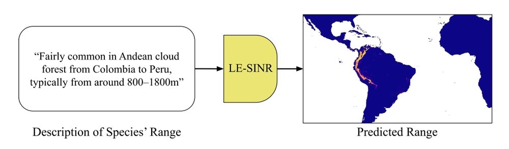
For the record, we need more shameless self plugs in this slack. I was talking to @Sara Beery about a google scholar feed into a channel, it will get people talking to each other.

Hi! I am working a lot on species distributions models and sadly there is not that much dataset of occurrences already paired with environmental variables... If you don't want to take to much time with GBIF, you should look on paper who release their dataset ! To link with environnemental variables, I recommend using Cmems Copernicus as there is an API for R and Python aswell. If you want something with already code prepared for the model, dataset (terrestrial species !), everything I recommend this paper for R : https://esajournals.onlinelibrary.wiley.com/doi/full/10.1002/ecm.1486 . If you are in Python, you can still use the dasatet from this paper and use a simple Random Forest but you need to take in account the problem of presence-only data as this is a major problem in marine dataset. Feel free to ask me any question :)) , I will be glad to help
There are larger efforts on this type of topic for things like coral species, you can poke through OSM (Ocean Sciences Meeting) and Oceans conference abstracts to hunt for this information. And also lots of papers on general species distributions, depending on the types of environmental variables and scale of species you are interested in. For marine a large dimension will also be depth.
Things like FathomNet might be a CS/ML-friendly starting point, since they have some environmental information for every image in addition to species-level labels laid out in a relatively easy to use API. Though more of a depth-slice perspective just off the Monterey coast, rather than a lateral global distribution perspective.
Hi everyone, on May 13, we are organizing a whole-day workshop/seminar on marine environmental monitoring and assessment using AI at Aalborg University, Denmark. It is a cross-disciplinary workshop between AI researchers, marine biologists, startups, industry, etc.. There will be talks, startup-pitches, a panel debate, and a poster session. It's free to participate and you can attend virtually (remember to sign-up). You can find more information at https://vap.aau.dk/memaai/

Is there anything that will be recorded so folks not there can listen in?
I hope to record everything - I'm still waiting for replies from the speakers regarding this 👌

Can we present a poster if we attend virtually?
Hi Alba, unfortunately not. The poster session is only for physical attendance. I'm sorry that was not clearly stated, I have edited the webpage just now.
@Carly Batist here is a link for the workshop recordings 🐟🎥

Hello again, just wanted to give a heads up. There will be a workshop on underwater computer vision and marine environmental monitoring held in conjunction with ICCV25 @ Hawaii in October. Paper submissions will be included in proceedings. Deadline for paper submission will be approx. ultimo June! More information coming as soon as possible. Cheers
That’s a bit of a shot in the dark, but is anyone in this channel looking for a phd involving scientific diving and significant ML model development? If so (or if you know of someone), please send me a DM. I am prospecting at the moment, no position open (for now)
The call for papers for the ICCV 2025 Joint Workshop on Marine Vision it out now.
We invite research contributions focused on computer vision in the underwater domain but also encourage submissions from other vision applications related to the marine environment, including in-air monitoring. (See list of topics on the website).
Timeline:
Submission deadline: June 30, 2025, End of day (GMT)
Author notification: July 11, 2025
Camera ready: August 8, 2025
Accepted papers will be published in the official ICCV 2025 workshop proceedings.
If you want to serve on the program committee (reviewing up to two papers), please reach out to me and I will send an invitation.
I am very happy to share that we got an impressing 23 full-paper submissions for the Joint Workshop on Marine Vision at ICCV25 (out of which 14 papers were accepted). The accepted papers cover a broad range of topics including object detection, coral reef datasets, underwater camera calibration, out-of-distribution detection, bridging the synth-to-real gap, and much more. We are going to have a blast at ICCV and I hope to see many of you! 🐢
If you missed the paper-submission deadline, but still want to be part of the workshop-shenanigans, fear not! You can submit that awesome paper from two years ago as a poster for the nectar track 🌊👌
(or you can simply show up and listen to some great speakers and interesting topics)
Find more information about the nectar track in the attached call for posters!
Hi all!
What's the latest in terms of general fish detector (MegaDetector style)? I remember there were some recently awesome efforts by @Filippo Varini and many others from the community to index datasets, but the newest model I've found is from two years ago by Daniel Young, Levi Cai and company. Anyone working on anything more recent?
I'm looking to analyze some videos from the Eastern Mediterranean, so more of a rocky reef type of situation rather than colorful coral reef species.
Thanks!
Hey @Shir Bar , yes a bounc of us from the community compiled ~30 open datasets into a universal fish detector dataset with ~500,000 images, extending Levi Cai’s model (thanks for their contribution!)
We’ll soon publish dataset, methodology and models!
Great to hear! Thanks @Filippo Varini :)

Nice initiative that could potentially enpower a lot of monitoring activities / systems
@Filippo Varini I work at Conservation International, and we have 2 projects using BRUV videos for MPA mgmt (Indonesia & Pacific Islands) who are interested in AI-based options for helping detect/classify species. We'd love to join this initiative! Who would be the best person to email about that? Thanks!
@Carly Batist Wasn't familiar with BRUV videos, just googled it. What kind of deployment durations are you using with that "protocol"?
Hi @Carly Batist, thanks for the message! Would love to collab! Feel free to email me at fppvrn@gmail.com
@Filippo Varini This is some example output from the edge ai "fish counter" / tracker I was working on ( selecting most interesting daily footage through rating of bounding box sizes ) https://www.youtube.com/@maldivescoralinstitute7179/videos the system is still operational but currently has some data upstream issues rsp. data is extracted but not published on youtube.
Few questions that popped up:
- Any midterm / longterm plans for fish species classification?
- Was wondering what kind of AI + human interactions you had in mind. Fish tracking / detection and then manual species classification through dedicated interface?
- Any ideas on how to tackle swarms of small fish? Maybe a dedicated classification for "homogenous" fish swarms? How are such swarms labeled in existing datasets?

@Adrian Ibanez great questions and they are all open, at least for the model we are developing right now.
This model will only detect fish, without classifying species or providing an interface for human interaction (similar to the land-focused Megadetector).
Having said that, if you have any idea on how to expand in any of the directions your questions point to it would be great to explore them!
@Adrian Ibanez it's not directly answering any of your questions, but maybe you can be inspired by the work of Guolei Sun on object counting in underwater scenes.
re-posting here, it seems relevant!
Is the 'agile modeling' termed used widely and I haven't seen it. Active learning + precomputed embeddings from foundation model? One of the challenges right now is just making sure everyone is clear on terminology, is that the basic premise?
Yup that's it basically. It goes something like this: (i) embed the whole dataset; (ii) embed a single target sample (a target fish sound in our case); (iii) cosine similarity search the embedded dataset to find closest matches to this embedded sample; (iv) label closest matches as positive or negative; (v) train a linear classifier on labelled data; (vi) classify entire embedded dataset with said classifier; (vii) pick a logit threshold to label some more samples around, usually close to 0 where the model is most uncertain; (viii) repeat v through viii.
This might be quite similar to other active learning approaches, though I'm no expert in that. The 'Search for Squawk' paper I shared in the post above builds off this 2023 paper that coined the agile modelling term: https://doi.org/10.48550/arXiv.2302.12948
Along the way I learnt a whole bunch of tricks that helped during the process and found it to be as much of an art as science in what logit threshold to pick, whether to focus on labelling more positive or negatives, what to do when even you as the human labeler aren't sure, etc. If anyone else reads this and wants to know more then I'd be happy to share.
thanks, I'm considering adding this into our airborne data tools. Good stuff.

Hi marine folks, is there a marine equivalent to the MegaDetector and SpeciesNet?
@Filippo Varini any news on the progress of the "megadetector" style marine model?
Hi @Adrian Ibanez, yes, we literally just released the first version of the model on GitHub!
https://aiforconservation.slack.com/archives/CLWGQ4BJ6/p1761669810110259


This is huge @Filippo Varini! Is there a road map so I can gauge where this is heading / what's next?
Our next step is improving the model by testing different architecture and data sampling strategies! We will keep you updated and welcome help!
For coral enthusiasts (and beyond), and fresh from the press!
We stress tested our dear DeepReefMap on 365 video transects on 45 diving sites and found remarkable consistency wrt time and acquisition conditions! This is a wonderful achievement of @Jonathan Sauder and shows that the model is robust!
https://www.nature.com/articles/s41598-025-20795-z


Hey all! I've been helping the Seattle Aquarium's Costal Climate Resilience program which uses ROVs to conduct surveys to understand kelp forrests and then several different machine learning models to enhance those images and then identify kelp and other species. We are starting to publish more of our work and datasets and code on github / huggingface if anyone is interested in learning more:
- Main program github: https://github.com/Seattle-Aquarium/Coastal_Climate_Resilience
- The training scripts / GUI program I've been heavily involved in developing for enhancing underwater images: https://github.com/keenanjohnson/underwater-auto-image-encoder
- Datasets and models: https://huggingface.co/Seattle-Aquarium
Unsure if this has been posted to the channel previously, but the 6th Marine Imaging Workshop (19-21st May, Gibraltar) is currently accepting abstract submissions until 30th January. Not affiliated with them at all, I just went to the last one and found it to be very useful for my research!
https://miw2026.org/
If anyone is attending the Ocean Sciences Meeting (OSM26) in Glasgow this feb and keen to meet up then let me know!
Excellent, lets definitely catch up in person this time! Are you presenting at all?
Sounds good. I have an eLightning poster, which I think means give a quickfire 3 min overview and then go stand next to a digital poster for a bit? Friday, 27 February 2026, 14:33 - 14:36, Hall 4
Sounds good, I'll be presenting right at the other end of the conference at 9:50am on the Monday in the soundscape section. Happy to reach out once it's kicked off to try and link up?
Sounds good, I will aim to come along for your talk 🙂
I'll be there. Not presenting, but am keen to meet up. We may have met at CVPR before.
Completely separately, have had some success producing some nice high res 3D twins of coral reefs using Gaussian splatting. Purely putting it here to show off! https://ben-williams-ai.github.io/splats/demo1/

Also putting this here

This is a great opportunity for anyone with strong computer/data/GIS science skills that wants to help build a new program. Based in St. Pete, FL https://fa-ewkd-saasfaprod1.fa.ocs.oraclecloud.com/hcmUI/CandidateExperience/en/sites/USF/job/42442/


@Rodrigo Oyanedel has joined the channel
Hello everyone.
@Kalindi Fonda and I are hosting a Vibe Coding Party on March 17th from 4pm to 7pm UK time (online) 😁 .
A Vibe Coding Party is a way for us to learn vibe coding tools. We will gather online use these tools to build a personal project. We will have the opportunity to learn from each other by sharing insights and receiving support from other vibe coders.
You can find more about the event here.
Everyone is welcome to join. Even if you have never programmed before, consider joining! These tools give us unprecedented opportunities to build websites/visualisations/games without needing to write code.
If you are interested in joining, please sign up by filling this form https://forms.gle/P6ZTTx41HD8wRa5s6
Thanks @Dan Morris for kickstarting these events and inspiring us to host more 🔥

There unofficial theme for the vibe coding party is “marine” so you are double invited 🥳 🌊 🥳


would be awesome to train something fishcounter style that runs on such a device. when I worked at streamocean.io a few years ago I had this "dream" of a team of cameras ( one lowpower, one fullframe camera ) that conserves battery by switching on the big boy on demand and capturing highres foto and video footage without running 24/7
appart from inspiring a bunch of children my personal fetish is creating highres multiyear timelapses like this one https://youtu.be/WehyLc5N_R4 ( 3 months )

Let me know if anyone is interested. I can provide the vision, locations and technology but no funding. my bottlenecks are data communication plans ( p2p mobile "data-gateway", mobile or starlink ) and funding of local staff for construction / maintenance

Hi I'm Andy,
I'd like to introduce my project to AI for Conservation Slack.
Here's what I'm working on :
In my spare time I starded building two semi-underwater vessels, a concept to make aquatic nature more accessible to the general public and to specialists. A smaller 1-person vessel and a larger vessel for 4 people.
These are my first prototypes designed for freshwater. They are currently largely ready for the first water-tests.
The orientation is for water exploration and water research.
- To offer immersive water experiences.
- To make aquatic nature more accessible.
- To encourage water exploration, discovery, and adventure.
- To conduct aquatic research.
- To better understand and protect water environments.
It is a work in progress, but to develop into a mature project I need (tech)partners, hence my request to AI for Conservation Slack.
Feel free to visit my website Aquatic Cradle Lab about my project, there's a translate button at the top.
Does anyone want to collaborate, and open up aquatic nature 🐬 ?
See you soon...
@Andy Delvaux interesting concept. how is your vessel boarded?
Hi Adrian, Both vessels are equipped with a hatch for entry. Sufficiently far above the water surface. Not watertight, but sufficient to keep the rain out. They are concept vessels, still subject to modifications and improvements.
Didn't see this one yet 😉 https://openmv.io/collections/accessories/products/genx320-camera-module?variant=42357017313374
Anyone familiar with spiking neural networks?


@Edwin Arkel Rios has joined the channel

Hi everyone,
Is anyone planning to attend the OCEANS conference in Monterey this September? I’m thinking of submitting a workshop or tutorial proposal and would love to collaborate with someone if possible.
If you’re planning to attend and might be interested in co-organizing a proposal, please let me know!
The deadline for abstract submission is April 20, so I’m hoping to start putting something together soon.

@Caroline Chan joined #marine. They’re also new to AI for Conservation.
output of vibecoding nvidia driver trouble shooting bullshit job 😉
running https://github.com/filippovarini/community-fish-detector?tab=readme-ov-file#models
will test on a nvidia jetson orin nano soon.
Very cool! Did you write your steps/process somewhere?
@Kalindi Fonda not yet. currently it has limited value as the events are only shown on the visualization. I'll build something that can be extracted / forwarded using the deepstream python api. that will be open source
I'm open to listen to requirements regarding edge AI realtime inference platform. My personal goals are more in the area of identifying "engaging footage" with lot's of fish. To trigger video recording and specially cloud uploads ( usually the biggest bottleneck / cost booster ).
Not so much research grade biodiversity / species metrics that are quite challenging.
If anyone is working on models to classify species I would be very interested to have an open conversation. deepstreams allows a cascading multi model approach with a low latency fish / no fish model triggering downstream inference using a more specialized model
Not spamming at all, that's why we are here for.
We are working on fish species. We dont need realtime yet, but it's a really cool to see. WOuld love to learn more, so that I can share with people who might be interested.
🙏 I'm cleaning up and will opensource the repo soonish. it's more about computing on the edge that realtime. sending tons of data or changing harddisks is a major pain for remote systems. but deepstream is definitely built for realtime. species classification could run downstream offline based on cropped fish classifications.
a bit of a mess and work in progress but at least opensource 😉 https://github.com/adiibanez/nature_counts
@Kalindi Fonda @Filippo Varini what about organising a brainstorming videocall at some point down the road to discuss current state of AI assisted "fish monitoring" approaches, potential strategies for better species rsp. biodiversity quantification / detection, collection of monitoring requirements, online / offline pros and cons, ...
Mark your calendars! The 2nd Workshop on Marine Vision will be organized in conjunction with ECCV 2026 in Sweden in September. We aim for multiple submission tracks, including a track for papers to be included in the official workshop proceedings.
More information to come 🐟📸🪸
Hello, is anyone going to the Marine Imaging Workshop 🙂 ?


Hi everyone,
quick question as I’m pretty new to this area 🙂
I’m currently looking for datasets for marine mammal detection and counting, mainly dolphins and seals from UAV or aerial imagery, but I’m a bit surprised how little I’m finding that’s openly available.
One dataset that would probably be very useful for what we want to do (seal counting from drone imagery) is this one [1], but it seems to be available only on request.
Then there’s some stuff from satellite imagery, like whales from space [2], but again, not that much that’s easily accessible.
I might just be missing something obvious, so please bear with me if that’s the case 🙂
Would really appreciate any pointers to datasets, benchmarks, or anything related!
Thanks a lot!
Matthias
[1] Filipe, Leonardo Viegas, et al. “Advancing marine mammal monitoring: Large-scale UAV delphinidae datasets and robust motion tracking for group size estimation.” Machine Learning with Applications (2025): 100808.
[2] Cubaynes, Hannah C., and Peter T. Fretwell. “Whales from space dataset, an annotated satellite image dataset of whales for training machine learning models.” Scientific Data 9.1 (2022): 245.

Hi @Matthias Zuerl, @Kevin Barnard reminded me of this presentation we saw at OSM this year that Corey Garza gave on an impressive pinniped detector. Might be worth reaching out to them for model/data info🦭

I try to keep track of all the aerial/UAV wildlife survey datasets I'm aware of here:
https://github.com/agentmorris/drone-wildlife-datasets
Without knowing more about your scenario, either of the following might be relevant:
https://www.kaggle.com/c/noaa-fisheries-steller-sea-lion-population-count
https://lila.science/datasets/noaa-arctic-seals-2019/
This one is borderline relevant... it has clear, low-altitude images of whales with a bit of spatial context around the whales (so it's plausible that you could put boxes on them), but I don't think it's intended as a detection dataset (the labels are individual IDs):
https://www.kaggle.com/c/noaa-right-whale-recognition

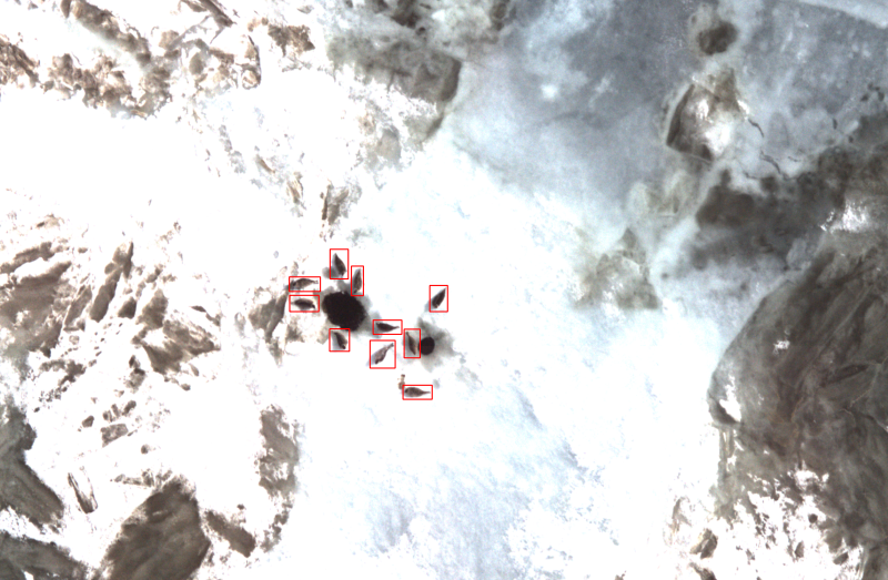

Hi Dan, thank you so much for your answer, that helps a lot!!
We have a large amount from airplane, not drone. https://www.sciencebase.gov/catalog/item/67d30bb8d34e1acf3979ce1d I haven't looked at these public releases for organization. Can you tell me a bit about your project we have a detector that works well that I could get to you.
@Ben Weinstein the description of that data suggests that it's unannotated... are there annotations available for the birds?
yes, that's what I meant, was typing from my phone, USGS doesn't make it massively easy to track all the pieces. There are annotations released with this (was before my involvement with this project) and another data dump coming very soon. I'm connecting with @Laura Chrobak fathomnet, today actually, to try to this better into the public domain. Getting federal partners onboard is a multi-year process, but my hope is that once we have one agency doing it, it will unlock others, I am aware of 10x data out there on drives and servers.
If you find the annotations and turns out that LILA can help get the data from "theoretically public" to "actually public", LMK. This is what we did with the Izembek data, which also began life on ScienceBase as "theoretically public".
yes, I think that's the thrust of it.
For that data it was so hard to get from ScienceBase (like physically hard to sustain a network connection, not in terms of permissions) that we ended up using a hard drive to transfer the data that eventually got to LILA.
Ooooh, definitely worth participating in this thread for the pictures.
https://www.sciencebase.gov/catalog/item/658da7c1d34e3265ab14bb00
@Matthias Zuerl I work with [2], if it would be helpful I can try and see if they can assist?
Hey @Dan Morris, @Ben Weinstein, @Cameron Trotter and @Laura Chrobak, Thanks so much for all your messages and the pointers to datasets and resources (and Pictures!!) I’ll go through everything with my colleague and might follow up with some of you. This already helps a lot! (This community is amazing 🙂)
@Ben Weinstein, I’ll check if I can get a few demo images of our problem. It’s related to the work of the NGO Yacu Pacha, specifically a project on counting seals along the coasts of Uruguay and Brazil.
Thanks again, everyone! 🙂
Motivated by this, i'm going to see if I can push a 'marine mammal detector' dolphin, seal, whale to deepforest this week. So you can pretrain from that our use it to mine data. Its piloted aircraft, so lower resolution that drone. If there is drone imagery around we can assess zero-shot generalization across resolution if anyone has a few images.
@Casey Youngflesh are there any public walrus images I could assess?
@Ben Weinstein Are your detectors publicly available?
Dear all, we are conducting a study on visual perception in underwater environments. If you have 15 minutes to spare, we would really appreciate if you could draw a bit on three images! 🌊 🐠 📸
Please note: It requires that you are using a computer and a mouse/touchpad (no touchscreen/phone!)
Thank you!
https://annotation-study.automate.vap.aau.dk/
Ps: I will give you a 'flødebolle' (look it up) at ECCV if you finish the survey 🙏🍫
The ECCV 2nd Workshop on Marine Vision Call for Papers are out! 🪸 🐟 📸
We invite full and short papers focused on computer vision in the underwater domain but also encourage submissions from other vision applications related to the marine environment, including in-air monitoring and remote sensing.
Full papers (included in the ECCV workshop proceedings):
Submission deadline: July 13th
Pages: 14 LNCS style
More information at: https://vap.aau.dk/marinevision/call-for-papers/
Short papers (NOT included in the ECCV proceedings):
Submission deadline: July 31st
Pages: 6 LNCS style
More information at: https://vap.aau.dk/marinevision/call-for-abstracts/
Springer PAA Special Issue on Marine Vision 🐳
All accepted full and short papers will after the workshop be invited to submit a journal paper on the topic to the Springer-Nature Pattern Analysis and Applications (PAA) Special Issue on Marine Vision edited by David Nakath, Joakim Bruslund Haurum, Anthony Hoogs, Alexandra Branzan Albu, and me.
More information at: https://link.springer.com/collections/hbjjbcfjbi
Sponsorship opportunities💰
Are your company interested in connecting with highly qualified machine learning and computer vision researchers enthusiastic about the marine environment? Look no further, reach out to Cameron Trotter to discuss possibilities of becoming a sponsor of the 2nd Workshop on Marine Vision European Conference on Computer Vision 2026.
On behalf of the organizing committee,
David Nakath, Joakim Bruslund Haurum, Cameron Trotter, Anthony Hoogs, Rupa Kurinchi-Vendhan, Justin Kay, Alexandra Branzan Albu, and Malte Pedersen
Go go marine vision workshop 💪 !

Hi everyone! I’m looking for recommendations of some marine mammal sound datasets with the following qualities:
- Audio is available at a native sampling rate that makes sense for the species present in the dataset (i.e., audio is not already resampled/preprocessed)
- Manageable size, doesn’t need to be huge
- Contains multiple species
- Ideally the dataset is used in some common benchmarks for animal vocalization classification. I’ve looked into the Watkins subset within BEANS but it is already resampled to 44.1 kHz.
Thank you for the help in advance!
I don't know of anything with these specs... @Rupa Kurinchi-Vendhan ?

Hey Julia!
- I'm pretty sure the NOAA PIPAN 200 kHz data contains the raw recordings (the 10 kHz dataset was fully resampled, so it's probably not what you're looking for) https://catalog.data.gov/dataset/pacific-islands-passive-acoustic-network-pipan-200-khz-data. This is a fairly large dataset, but you can always export a year's worth of data to work with.
- I know that the ATBFL dataset contains blue and fin whale calls and it contains all raw recordings: https://data.aad.gov.au/metadata/records/AcousticTrends_BlueFinLibrary. This is also a fairly large dataset, but there were processed subsets that were made for the BioDCASE challenges (https://zenodo.org/records/15092732 and https://zenodo.org/records/19133112).
- Have you looked at any of the DCLDE datasets from the last several years? I haven't worked with any of them directly, but there the odontocete (DCLDE 2018) and ecotype (DCLDE 2026) datasets. I'm pretty sure these are not raw recordings, but they are resampled to better represent the vocalization range of the species in the datasets.
Thanks so much @Rupa Kurinchi-Vendhan and @Sara Beery this is so helpful! I hadn’t seen the NOAA PIPAN or DCLDE datasets in my search. I may play with one of the BioDCASE datasets (either the active learning task as you listed above or task 2!) since they’re relatively small to start with. Thanks for all the resources this is awesome!
This looks like a great opportunity!

Bay Area folks - come learn about the microscopic life surrounding the Bay buoy and nerd out with the FathomNet team!
We will be at two Exploratorium (Pier 15, San Francisco) events this month, giving talks and sharing the latest from our work:
🌙 After Dark: Splashdown
📅 Thu, Jul 30 · 6–10pm
Adults-only evening exploring extremophiles in the Bay and what they can teach us about the search for extraterrestrial life.
🔗 exploratorium.edu/visit/calendar/after-dark-splashdown
☀️ Bay Day
📅 Sat, Aug 1 · 11am–4pm
Family-friendly day taking a look at the microscopic life surrounding the Exploratorium's NOAA buoy - see how that data helps track climate change and sea level rise.
🔗 exploratorium.edu/visit/calendar/bay-day
📍 Both at Pier 15, San Francisco
Come learn what's new and chat with the team 🙌


Hello all,
we have now opened for submissions to the NECTAR track of the 2nd Workshop on Marine Vision (+ Extended the deadline for our full paper submissions)! 🫧 📸 🐟 🪸
Nectar track:
We invite poster presentations of previously peer-reviewed work from the past three years that are relevant to the workshop’s themes.
Submission deadline: August 14
More info at: vap.aau.dk/marinevision/nectar-track
The deadline for full paper submissions (to be included in the ECCV Workshop Proceedings) has been extended.
New submission deadline: July 15
More info at: vap.aau.dk/marinevision/call-for-papers
PS: Don't know what to spend your Summer on? Look no further, send me a message and I will sign you up as a reviewer for our workshop!
PPS: By signing up as a reviewer you will also do all your great colleagues, who have already signed up, a favor by reducing their review workload. So it's a win-win situation!
Hope to see many of you at ECCV'26 in September! :flag_se:
Question regarding adapting high-resolution detectors for smaller resolution imagery: I recently tested out @Cameron Trotter's Antarctic detector on some smaller-resolution imagery to see if it could transfer. Awesome work here if you haven't yet checked it out! I tried a few things, including adjusting the patch size, upscaling the imagery, and disabling SAHI, but had no luck. Curious if anyone else has experimented with something similar and had better success?
Our experience is that this is the fundamental limitation right now and we've seen it across multiple domains. I have a figure from the MillionTrees Airborne Tree Detection Manuscript, which is the same idea. You can take the same model weights and the same image but the hyperparameters around preparing the image and within the model post-processing, you get wildly different results.
Right now however, we're training machinery models. They're definitely brittle enough where these kinds of presentations and image resolution differences are really key. I'm actually putting a grant together about this idea if anyone wants to discuss.
What we know so far is that dumping a bunch of datasets of different resolutions and different capture elevations into one giant pile and training on it does not really seem to address the key issue. Nor does all sorts of augmentations and zooming in and zooming out. I've got a couple papers that touch on this a little bit that we've played with but they don't really get at the heart of what's happening here, which I think is deeper.
Thanks for the context @Ben Weinstein! and good to know that I wasn't overlooking a quick fix. Seems like a solution to this would be really powerful for making these models more transferable across different types of imagery.
Great to hear you're finding some use in the work @Laura Chrobak, happy to chat any time if you think it would be helpful. I've tried running imagery from a different benthic survey, at a different resolution, through our model and I also saw a pretty big drop in performance, although I haven't had time to experiment with changing hyperparameters etc yet. There are also likely other factors affecting performance though, since it's a completely different camera system and environmental conditions. I'd really like to explore issues around multiple sources of domain shift in marine CV, but I haven't found the funding for that yet, sadly.
@Ben Weinstein do you have links to the papers you mention at the end of the post? Would be interested in reading them!

I will shortly be advertising THREE postdoctoral positions (2 x 3yr, 1 x 2yr) at the intersection of AI + behavioural ecology + conservation based at Lancaster University, UK. We will be using coral reefs as a model system, with later transfer to UK waters.
Keep an eye out here for full adverts - I will post them once they are live. Please do feel free to email / DM me in the mean time for further info 🙂
[ MESSAGE TEXT EMPTY ]


Hi everyone! I’m looking for an annotated dataset of kelp (any species) observations in Europe, preferably > year 2016 with both present and absent observations. Already explored GBIF, JNCC, OBIS. Thanks a lot!
Hello all,
Good news: we received more short papers than expected for the 2nd workshop on marine vision (ECCV)! 🎉
Bad news: I underestimated the number of reviewers we needed 🤥
Feel free to contact me, if you have time to assist with some light-weight reviewing of non-archival short papers in the coming week! 🐟💦🪸

Thank you @Shir Bar and @Zee, it means a lot!! 🙏
You should have received an invitation by now.

Hello, I'm Arya and I've been part of a team called SeaLens. We are developing a tool to help scientists from coral restoration groups to do fish monitoring by utilizing computer vision to quickly detect, count and specify fish. We started from a restoration site in Bali and are testing the app right now, evaluating if it properly support scientists in their restoration process. The goal is to help scientists with faster decision making for their next restoration steps and to get biodiversity data and reports more easily.
Please feel free to try out the app here: sealens.app. Our current challenge is the lack of indonesian underwater fish images available, so we are actively processing videos in that region to gather more images and use it for further improvement of our dataset.
If you are part of or in contact with a coral restoration organization, we would be happy to connect

Curious about what do you use for detecting fish/species? Which models are you finetuning?
Your page says you can do 100+ species, what have you found the model struggles with the most?
At Spyfish, we are finetuning the Community Fish Detector, and we "promote" a fish into a species when we have a few hundred annotations.
REMINDER! The deadline for the 2nd Workshop on Marine Vision NECTAR track is coming up on August 14!
We invite posters presenting previously peer-reviewed work published in a top-tier conference or journal within the past three years.
Submission deadline: August 14
More info at: lnkd.in/dJpwaSnU

Hi All, Excited for the upcoming OCEANS conference, September 21-24th in Monterey, CA! I wanted to get a pulse on who was planning to attend; it would be great to connect while we are there. 🪸
WHi All,
Interesting postdoc opporutnity at UT Austin!
https://utaustin.wd1.myworkdayjobs.com/UTstaff/job/AUSTIN-TX/Postdoctoral-Fellow_R_00046894-1
2 #postdoc positions now live (3rd on the way)! 🐠🐡🐟
(1) #AI for #Ecology hr-jobs.lancs.ac.uk/Vacancy.aspx?… 2yrs 9m, £39.9k+
(2) #Marine Field Ecology for AI-Enabled Behavioural Monitoring hr-jobs.lancs.ac.uk/Vacancy.aspx?… 2yrs, £39.9k+
(3) AI-Enabled #BehaviouralEcology for #Conservation, link soon, 2yrs 9m, £39.9k+
Join our team, unlock #AnimalBehaviour as an early warning system.
Deadline for all 13th Sept


3rd postdoc (AI-Enabled #BehaviouralEcology for #Conservation) info available here: drive.google.com/drive/folders/…?usp=drive_link in advance of application portal opening up


I've not been as active on slack lately, if anyone's interested to reach out you can get me on ben@echolabs.org
Hello all, the Pioneer Centre for AI's program on AI for Marine Perception is organizing a social evening in conjunction with the 2nd Workshop on Marine Vision (ECCV).
Date: Tuesday, September 8
Where: Far I Hatten, Malmö, Sweden
When: 19.00-23.00
We have booked 40 seats, so sign up now to get a spot (they have space for 80 seated and 200 mingling people, so there should be room for everyone though, and we can "share" seats if needed)
Sign up and find more information here!

Postdoc position available at the section for Visual Computing at DTU Compute, Copenhagen, Denmark.
The position is part of the HAV-INNO project, a multi-disciplinary collaboration at the intersection of computer vision, AI, and marine biology.
efzu.fa.em2.oraclecloud.com/hcmUI/…/7931?…


🌊 𝗠𝗮𝗖𝗩𝗶 @ 𝗪𝗔𝗖𝗩 𝟮𝟬𝟮𝟳 – 𝗖𝗮𝗹𝗹 𝗳𝗼𝗿 𝗣𝗮𝗽𝗲𝗿𝘀 🌊
The 5th Workshop on Maritime Computer Vision (MaCVi) has been accepted at #WACV2027 in Orlando, FL, and we're now inviting submissions! ⚓
If your work involves perception above the surface, below it, or from the air, this is the venue for you.
📌 𝗧𝗼𝗽𝗶𝗰𝘀 𝗶𝗻𝗰𝗹𝘂𝗱𝗲:
- Detection, tracking, segmentation and re-identification in maritime scenes
- Underwater image and video restoration and enhancement
- Vessel perception, obstacle detection, navigation and SLAM
- Aerial and remote sensing for search and rescue, mapping and - environmental monitoring
- Multimodal fusion (optical, thermal, sonar, radar, AIS)
- Adverse weather, low light and turbid water perception
- Foundation models, VLMs, synthetic data and sim-to-real transfer
- Efficient onboard vision, robustness, datasets and benchmarks
🚨 Benchmark challenges spanning underwater and surface perception are coming, including sonar and edge tracks. Details soon on the challenges page and our Discord.
📅 𝗗𝗮𝘁𝗲𝘀 (provisional, AoE):
Submission deadline: November 1, 2026
Notification: November 15, 2026
Camera ready: November 20, 2026
🔗 Learn more: macvi.org/workshop/macvi27
🔗 Openreview submission page: openreview.net/group?…#…
💬 Community Discord: discord.gg/vQhHysznm
👥 Organized by Benjamin Kiefer, Uma Mudenagudi, Xiaomin Lin, Chen Chen, Chaitra Desai, Sneha Varur, Yi Sheng, Ramesh Ashok Tabib, Sujatha C, Dr. Tusar Kanti Mishra, Jan Lukas Augustin , Nikhil Akalwadi, Sampada Malagi, Trung Tien Dong, Arnold Wiliem, Matej Kristan, Janez Pers, Mingi Jeong, Alberto Quattrini Li, Jon Muhovič, Matija Teršek, Leonardo Bobadilla, Jaejeong (Jane) Shin
See you in Orlando! 🌴
#WACV2027 #MaCVi #ComputerVision #MaritimeAI #UnderwaterVision #MarineRobotics #DeepLearning
